
Do you work with wide range of grid formats and need an easy-to-use graphical interface to manipulate and display your data? | Trabajas con grandes matrices de datos geográficos y necesitas de una interface sencilla de manejar y visualizar tus datos?
Description:
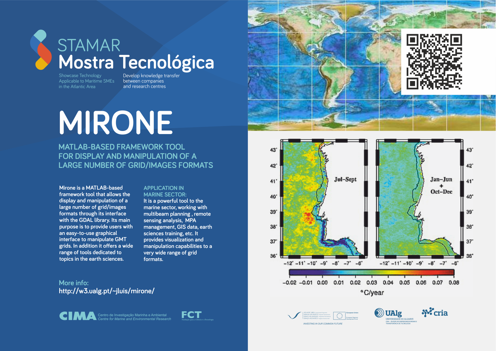
Mirone is a Matlab-based framework tool that allows the display and manipulation of large number of grid/images formats through its interface with the GDAL library. Its main purpose is to provide users with an easy-to-use graphical interface to manipulate GMT grids. In addition it offers a wide range of tools dedicated to topics in the earth sciences.
Apllication in Marine Sector:
It is a powerful tool to the marine sector, working with multibeam planning , remote sensing analysis, MPA managment, GIS data , earth sciences training, etc. It provides vizualization and manipulation capabilities to a very wide range of grid formats.
More info: http://w3.ualg.pt/~jluis/mirone
Compartir:
Related Posts

STAMAR Interview: Cristiano Soares. Management and R&D. MarSensing Lda.
MarSensing, created as a spin-off project of SiPLAB located at the University... Read more

STAMAR interview - Panagiotis kaklis. Naval Architecture, Ocean and Marine Engineering
Within the University of Strathclyde, there is the Strathclyde Marine Institute... Read more

STAMAR Interview: Verónica Tellado Barcia. Head of the Nature Conservation Directorate General
One of the main goals of the National Park is to contribute to the promotion of... Read more


